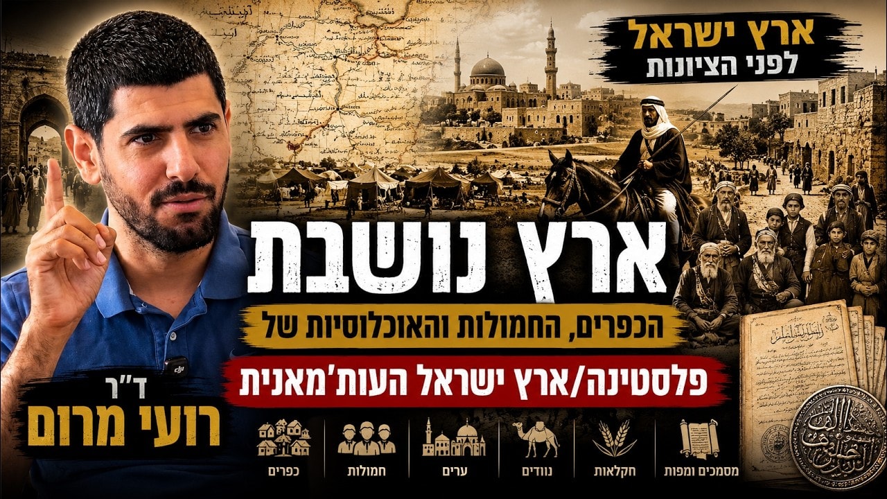
What was the Land of Israel like before Zionism? Who lived here? How were villages organized? What did people mean when they said, “We have been here forever”?
The honest answer is not a neat slogan. It is a crowded, moving, sometimes messy human story. People arrived, people left, villages rose, villages faded, families split, clans fought, and old place names survived even as the people who used them changed completely.
This was not an empty land. But it was not a frozen land either.
To understand the Ottoman centuries, we have to get close to the ground: the field, the spring, the path, the ruined site, the tax register, the shared courtyard, and the local memory. That is where the long history becomes real.
Takeaways
- Ottoman Palestine was an inhabited, diverse, and constantly changing landscape.
- Villages were organized through households, clans, local sheiks, and tax networks.
- Population origins combined long local roots with repeated migration across the Levant.
- Modern national conflict emerged gradually from older local relationships and disputes.
A Historical Geographer’s View From the Ground Up
Historical geography sits at the meeting point of history, archaeology, and landscape. An archaeologist often starts with material culture: pottery, tools, buildings, and changing styles. A historian often begins with written sources, letters, official documents, and books.
A historical geographer begins with the landscape itself.
That means asking questions like these:
- Where was the village located?
- Which fields belonged to it?
- Where did its water come from?
- Which road linked it to the market town?
- Who controlled the land?
- What happened when neighboring clans went to war?
Each discipline sees something valuable. But when every field stays in its own sealed box, the larger picture gets lost. Written sources may miss the physical world. Archaeology may not fully explain later social life. Local traditions can preserve real memories, but they can also mix several eras into one powerful story.
The goal is not to pretend we know everything. The goal is to separate what can be known from what remains uncertain.
That broader approach can help identify ancient sites, rethink archaeological identifications, reconstruct the changing borders of kingdoms such as Judah, or understand how a city like Megiddo functioned within its surrounding countryside. It is equally useful for the Ottoman period, when the villages, clans, fields, and tax systems of the land became much clearer.
A Land of Changing Places & Persistent Names
Even one hill can tell the story of centuries of change.
Consider an area near Jerusalem that was once known in Arabic as Karm al-Rahban, roughly “the monks’ vineyard.” Before 1948, the land belonged to a church. Early photographs show only a handful of olive trees, yet the place was understood as a cultivated orchard landscape. In local usage, a karm could include olives, figs, grapes, and other productive trees.
Go back much further, and the same area may connect to an ancient Judean place name. Over time, a name is reinterpreted, translated, reshaped, or attached to a new folk explanation. A name that once meant one thing may later be explained by a completely different story, such as the supposed salty water in a place where the water was never salty at all.
Places change. Populations change. Clan structures change. But old names can linger like footprints in the soil.
This is why local history cannot be reduced to a single date or a single population count. The answer depends on when exactly you arrive, where you stand, and even what season it is.
In autumn, agricultural activity would be visible across many areas: barley, wheat, orchards, flocks, and small-scale cultivation. In another season, the same landscape could look sparse and abandoned.
Population in Ottoman Palestine: Numbers that Need Context
The Ottoman authorities conducted population and tax surveys after they took control of the region in the early sixteenth century. These registers generally counted adult men liable for taxation, not every individual in a household. Researchers therefore estimate the total population by adding family members, often using a rough household figure of four to five people.
By the late sixteenth century, the country’s estimated population was around a quarter of a million. By the late nineteenth century, it had risen to close to half a million.
Those numbers matter, but they should not be used as a shortcut to a political conclusion. Population density rose and fell across long stretches of history. In many earlier periods, the land’s population ranged between 100,000 and 200,000 people. There were periods of heavier settlement, periods of insecurity, and periods when people moved away or gathered in safer places.
The late medieval and early Ottoman periods were not uniformly empty or uniformly crowded. They were marked by uneven settlement, insecurity in some regions, mobility, and continual local change.
A low population count does not mean nobody was there. It means the landscape was lived in differently.
There is also a major source problem. After the 1597 Ottoman register, there is a long gap before more detailed nineteenth-century data becomes available. That gap forces historians to work carefully, combining tax records, travel accounts, local traditions, archaeology, and later administrative materials.
What a Village World Looked Like
Most people lived in a rural world of peasants, villages, households, clans, and local strongmen. The Arabic term hamula, commonly used in Palestine to refer to an extended clan, captures something essential about this social structure.
A typical home was small and practical. It might be one room, perhaps four by four or five by five meters, with one door, few or no windows, and a place for smoke to escape through the roof. Parents, children, and sometimes grandparents lived together in a shared compound.
Several related households formed a larger kinship group. Multiple clan groups could form a village quarter, a village, or a small tribal network. These groups might marry into one another, cooperate, feud, divide, or unite against a neighboring village.
Above the village stood wider networks of villages, often grouped in Ottoman administrative districts known as nahiya. A local sheik might lead a cluster of villages, while stronger figures in a town exercised power at a higher level. Their role was deeply tied to taxation and the management of imperial authority.
- Household: Parents, children, and often older relatives sharing living space.
- Hamula: A wider kin group built around real or claimed descent.
- Village: A local community made up of several family and clan networks.
- Nahiya: A district linking multiple villages under local leadership.
- Imperial administration: Ottoman officials, military figures, judges, and tax collectors.
The village was not a peaceful postcard. It could be a world of alliances, rivalries, debts, raids, and very sharp memories.
Movement was common despite Ottoman attempts to keep people attached to their registered places of residence. The state wanted a stable tax base. If a household moved, it took taxable labor, animals, crops, marriages, and property with it.
But people still moved. When the histories of villages are examined closely, many families turn out to have origins in dozens of different places. Migration was not an exception. It was one of the basic facts of life.
Taxes, Power & the Ottoman State
How much did a peasant actually feel the Ottoman Empire?
Mostly through taxes.
A modern state not only collects taxes but also provides roads, schools, health services, police, and other public services. The Ottoman state had courts and mechanisms for settling disputes, and it could intervene against extreme abuse. But for many villagers, the state was most visible at harvest time or when a tax collector arrived.
Taxes could be charged on crops, livestock, honey, marriages, land, and personal status. Non-Muslims also faced specific poll taxes, including the jizya.
Tax collection was often indirect. Rather than collecting payments directly, the state relied on local intermediaries, sheiks, officials, and military figures. These men could take more than the state was formally owed, using their position to enrich themselves and build local power.
When the tax collector came, the empire stopped being an abstract idea.
Resistance could take many forms. People hid property, underreported land, fled, delayed payments, or openly rebelled. In the language of empire, refusing taxes could be treated as rebellion. The response might be harsh, including armed force and the destruction of a village.
The Tanzimat Changed the Rules
During the nineteenth-century Tanzimat reforms, the Ottoman Empire tried to bring land, people, and military service under far tighter central control.
Previously, a register might focus mainly on adult men for taxation. The reformed state wanted more. It entered households, recorded names, parents, ages, and other details. These population registers had a clear purpose: when boys reached military age, the state would know where to find them.
Land registration became more invasive, too. A family that had informally used a large area might register only a small part of it in order to reduce taxes. Later, when formal land arrangements were reconsidered, these old choices could become a source of serious conflict.
The Tanzimat did not simply make the empire more efficient. It also brought the state directly into homes, fields, and family life. That created new tensions and new demands for rights.
The Many Communities of the Land
Ottoman Palestine was not composed of a single Muslim population and a small number of outsiders. It was a varied mosaic of communities, languages, local traditions, and migration histories.
Jewish Communities
Jewish communities existed in Jerusalem, Safed, Hebron, Acre, Peki’in, Kafr Yasif, Kafr Anan, and other places. In the Galilee, some rural Jewish communities appear to have maintained continuity, in one form or another, from late antiquity.
These were not communities cut off from their surroundings. Many spoke Arabic as their daily language, cultivated land like their neighbors, and lived within the wider rural economy. Yet they maintained synagogues, communal traditions, and sacred burial sites associated with Jewish holy figures.
In the sixteenth century, Jewish communities were estimated at roughly 2 to 5 percent of the total population. They included long-established local communities as well as Sephardic arrivals from the Iberian Peninsula, bringing Ladino culture and new communal networks.
Ottoman registers from Safed are especially revealing. They list Jewish communities by their places of origin in Iberia, sometimes in greater detail than do surviving Jewish sources from the same period.
Safed became a remarkable center of Jewish life and Kabbalah. Its importance was not accidental. It was one of the country’s largest cities, probably second only to Gaza in that era, with trade, wealth, diverse Jewish communities, and patrons able to support religious and intellectual activity.
Kabbalah did not grow in a vacuum. It grew in a busy city with people, money, paper, trade, and community life.
From the eighteenth and nineteenth centuries onward, larger waves of Jewish immigration arrived from Eastern and Western Europe, including Hasidic communities and other groups. Many came to live and be buried in the Holy Land. By around 1900, Jews made up a little more than 10 percent of the country’s population.
Christians, Samaritans & Druze
Christian communities were present in cities and, in particular, in rural areas, although their nineteenth- and twentieth-century distribution was not always the same as in earlier Ottoman centuries. In the sixteenth century, Christians made up roughly 10 to 12 percent of the population, according to major studies of Ottoman records.
Samaritans remained an important urban community, especially in Nablus and Gaza, with smaller connections elsewhere in the region. By this period, they were no longer centered in Samaritan villages. Their religious traditions and sacred places survived in changing circumstances.
The Druze were also a deeply rooted community, especially in northern areas. Their religious tradition developed in the early eleventh century. Over centuries, they formed a continuous geographic belt across parts of the Galilee and the wider Levant.
Genetic research on the Druze and other regional populations points to a complex picture of local roots mixed with external influences. That is not surprising. The Levant has always been a crossroads.
Turkmen, Kurds & Other Migrant Communities
Turkmen and Kurdish communities were visible in Ottoman cities and rural regions. Urban quarters could be known as the Turkmen quarter or the Kurdish quarter.
Many Kurds came into the region in connection with Saladin’s campaigns against the Crusaders. Saladin himself was Kurdish, and Kurdish military and settlement networks spread through Syria and into the Land of Israel. In Hebron, Kurdish communities existed until violent internal conflicts devastated them in the early nineteenth century.
Turkmen communities had deeper roots in the region, connected to Turkic groups that expanded into the Middle East from the eleventh century onward. Some Turkmen groups maintained distinct language and cultural practices, with settlements in areas such as the coastal plain and Jezreel Valley.
In Gaza’s Shuja’iyya neighborhood, one of the historic components was a Turkmen quarter. The population identity may fade or transform, but the name can remain.
Bedouin & Buffalo Herders
Bedouin tribes were a major force in the countryside. They could act as pastoralists, traders, raiders, protectors, tax collectors, or all of those things at different moments. Their relationships with settled farmers were often tense, especially where protection payments and raids were involved.
Along the coastal plain, some groups were associated with water buffalo herding. The Arabic term associated with these groups derives from jamus, meaning “buffalo”. Water buffalo, introduced to the region through long-standing historical processes, thrived in wetland environments and produced substantial amounts of milk.
These communities remind us that the land was not divided simply between towns and farming villages. Marshes, grazing zones, seasonal routes, and mobile populations were part of the same human map.
Stories of Origin: Ancient Roots, Migration & Memory
Every community tells stories about where it came from. That is true of biblical Israel and of Arab villages and clans in Palestine.
Some modern Palestinian narratives emphasize Canaanite origins and uninterrupted antiquity. But this is a modern national story, shaped by the political conditions of the last century. Earlier local traditions were often different.
In many village accounts from the nineteenth and early twentieth centuries, families described themselves as arriving with the Muslim conquest, coming from the Arabian Peninsula, joining Saladin’s armies, or arriving from Egypt with Ibrahim Pasha. Others said simply: “We have been here from father to grandfather, generation after generation.”
These stories do not always agree with one another. A single family or village may hold multiple versions at once.
Human memory is not a filing cabinet. It is a living story, patched together across generations.
When researchers examine clans in detail, they often find many origins inside one supposedly unified group. Families came from Egypt, Transjordan, Syria, the Hauran, the Arabian Peninsula, other Palestinian villages, and nearby regions. At the same time, many lineages did have deep local roots.
This pattern is not unique. Biblical texts themselves preserve more than one origin story for Israel: Exodus from Egypt, ancestors from Aram, local Canaanite connections, and the incorporation of many different groups.
The Levant’s borders have never been simple. Why should the country end at Metula? Why should the Hauran, southern Lebanon, northern Jordan, Sinai, and the coastal plain be treated as worlds with no human connection? Families crossed these spaces constantly.
What Genetics Can & Cannot Tell Us
Genetic research adds another layer, but it does not hand anyone a simple certificate of ownership.
Studies discussed in this context suggest that roughly 40 to 60 percent of Palestinians may carry paternal or maternal genetic lineages with very ancient Levantine connections, reaching back to prehistoric periods. These lineages are often associated in popular discussion with haplogroups such as J1 and J2.
But the story does not stop there. Those lineages themselves have long and complicated histories. Over thousands of years, people moved from the Levant into Arabia, Yemen, the Horn of Africa, and other regions, and later returned in subsequent migration waves. A population may carry an ancient regional lineage while also having ancestors who arrived through much later migrations.
Jewish populations also include Levantine genetic roots alongside the many demographic influences of diaspora history, conversion, and local admixture.
DNA can show connections. It cannot flatten thousands of years of movement into one tidy sentence.
The useful lesson is complexity. Some families have ancient local ancestry. Some arrived in the medieval or Ottoman periods. Many have both. And across the centuries, people also left the country in large numbers for Egypt, Syria, the Hauran, Yemen, and beyond.
From Local Friction to National Conflict
By the late nineteenth century, new groups were arriving in the region under difficult conditions. Jews fleeing Antisemitism and pressure in the Russian Empire came to the Middle East, though the great majority of Jewish migrants went to the United States rather than Palestine.
Other displaced Muslim populations arrived as well. Circassians were expelled from the Caucasus by the Russian Empire in the 1860s. Bosnians arrived following the upheavals of Ottoman losses in the Balkans. Tatars, Bulgarians, Turks, and others were also part of this broad movement.
These groups often brought different languages, military experience, literacy levels, settlement habits, and ideas of modernization. They encountered local farmers, Bedouin, Turkmen, long-established urban communities, and other migrants.
The encounters could be cooperative, hostile, or both.
Hadera: A Russian-Speaking Meeting Point
Hadera offers a striking example. Near the area were Circassian settlements, and Bosnian communities were not far away. In local inns, Jewish settlers, Circassians, and Bosnians could sit together, drink tea, and speak Russian.
At times, these groups formed practical alliances when nearby villagers attacked settlements or contested land. Such incidents were not yet necessarily framed as a national struggle between two unified peoples. They were often local disputes over land, security, access, and survival.
Reihaniya: Planning, Settlement & Conflict
Reihaniya in the north is another fascinating case. It is widely identified with Circassian culture, though its population also included Tatars, Bulgarians, Turks, and other communities that gradually became culturally Circassian.
The Ottoman authorities established the settlement with planned streets, fortifications, a wall, and a gate. An Ottoman inscription praised Sultan Abdul Hamid for allowing displaced Muslims to settle there.
Yet the settlement’s story also included conflict with nearby Arab villages. The gate inscription was reportedly damaged by stones. The pattern is familiar: newcomers settled, local people felt threatened or dispossessed, and violence followed.
Settlement was rarely a clean beginning. It was usually a collision of needs, fears, hopes, and competing claims.
Why the Earliest Conflicts Were Not Yet “Zero-Sum”
It is tempting to imagine that the Jewish-Arab conflict began the moment the first modern Jewish agricultural colonies appeared. The historical picture is more complicated.
For decades, Arabs, Jews, and other groups lived and worked in and around colonies in varied ways. Some colonies gradually replaced older village landscapes. Others included Arab laborers, tenants, and neighboring communities. The local world was shaped as much by personal ties and practical arrangements as by larger ideologies.
National identities became sharper, especially with the Second Aliyah in the early twentieth century. As Jewish national organizations grew, people increasingly had to choose sides defined through religion and national belonging.
Circassians and Bosnians were Muslims and were therefore often absorbed into the wider Muslim political category. Jews, including Ashkenazim, Sephardim, and Yemenite immigrants, were increasingly grouped together as a distinct non-Muslim national community.
That was the beginning of the modern tragedy: a conflict that became framed as “us or them,” even though the older social reality had been much more tangled.
The Forgotten Jewish Settlements of the Bashan
Across the Bashan and Hauran region, Jewish settlements were founded in the late Ottoman era. Some were associated with Baron Rothschild’s networks and carried names linked to his family.
There were roughly thirteen or fourteen such sites. Some struggled because conditions were difficult. Others survived for years before being abandoned under pressure or violence. In some cases, Jewish-founded settlements later became Arab villages.
One especially painful example was Bnei Yehuda, not the modern community in the Golan Heights, but an earlier settlement near what is now the southern Golan area. It was established by long-established Jewish families from Safed and nearby Galilean communities, not only by recent immigrants from Eastern Europe.
They brought agricultural workers and settled people from their wider regional networks. During the chaos around 1920, when the boundary between British and French-controlled territories was unclear and authority was weak, the last Jewish family there was murdered.
Later local accounts sometimes denied that non-Arabs or non-Muslims had lived in these places. But when the story was pressed, memories of the Jewish settlement and its destruction could emerge.
The landscape keeps records. So do families. Sometimes the record only comes out after the first version of the story cracks.
A Bigger Picture than Any Single Slogan
Ottoman Palestine was inhabited by a dense web of communities: Muslim villagers, Bedouin tribes, urban notables, Christians, Jews, Samaritans, Druze, Turkmen, Kurds, Circassians, Bosnians, Egyptians, and others.
Some had roots that went back centuries or longer. Some arrived in the Ottoman period. Some moved from one village to another. Some came from Syria, Egypt, the Caucasus, Anatolia, the Balkans, or Yemen. Some left for those same regions.
There was no single origin story that could explain everybody.
And that is exactly what makes the history worth studying. It does not provide a magic political answer. It provides something more useful: a clearer view of human reality.
A serious history does not belong to one political camp. It makes every easy story work a little harder.
To understand the land, start small. Look at the village. Look at the family compound. Look at the tax register. Look at the road. Look at the orchard. Then widen the frame, and the full complexity begins to appear.
People often ask…
How many people lived in Ottoman Palestine in the sixteenth century?
Late sixteenth-century estimates based on Ottoman tax registers place the population at roughly a quarter of a million people.
Did Ottoman population registers count everyone?
Not usually. Early registers mainly counted adult men responsible for taxes, so historians estimate the total population by accounting for households and dependents.
What was a hamula in Palestinian village society?
A hamula was an extended clan network. Several related households could share a compound, form a village quarter, and build alliances or rivalries with other clan groups.
Were there Jewish communities in the Land before modern Zionism?
Yes. Jewish communities lived in cities such as Jerusalem, Safed, Hebron, and Acre, as well as in several Galilean villages. They included long-established local communities and later Sephardic and European arrivals.
RESOURCES:
This article was created from the video Inhabited Land: Villages, Clans & Communities in Ottoman Palestine (Pt1 HEB) | https://www.youtube.com/watch?v=ncXfp7zd9hk with the help of AI. | PHOTOS & VIDEOS Use According to Section 27 A
Watch More: Jewish History...
- Abraham – One Man Chose a Different Path
- Timeline of Jewish History
- Tower of Babel & the Origin of Languages
- 1177 BC: How the First Globalized World Fell Apart
- Nineveh: The Greatest City Erased from History
- Babylon in 570 BC: Inside the City That Shaped the World
- Nebuchadnezzar, Solomon’s Temple & the Fire that Changed Jerusalem
- Hezekiah’s Tunnel: Faith, Fear & Water Beneath Jerusalem
- “Rivers of Babylon” Written in Exile 2600 Years Ago
- Nebuchadnezzar: The King Who Built Babylon, Lost Everything & Returned
- Secret of Jewish Survival & Esther’s Courage
- Canaan to Rome: The Ancient History of Israel
- Arch of Titus: Rome’s Monument of Triumph & Jewish Heartbreak
- Roman Empire: The Rise, The Madness, The Fall of a Civilization
- Fall of Rome: How the Ancient World’s Greatest Empire Changed Shape
- When Nations Turn Against Israel, What Happens to Them?
- ‘All Things Are Mortal But the Jew’ – Mark Twain
- 7 Wonders of Jewish History: A Story That Should Not Be Possible
- Samaritans: Last 800 Guardians of Mount Gerizim
- Amalek Command: Why It's Misunderstood
- PART 1 | The Land of Israel & Ottoman Palestine (HEB)
- Part 2 | The Land Reached Its Peak & Byzantine Palestine’s Demographic High Point (HEB)
- PART 3 | Arab Conquest: How the Land Gradually Became Muslim (HEB)
- 5000 Years of Jewish History (5-Min Clips)